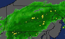
(WFMZ) – Stay weather alert Wednesday! It’s our third tropical system in as many weeks, and it will pack a punch later in the day and tonight, especially overnight with heavy rain, strong storms, and the potential for both flooding and tornadoes, depending on where you are.
From the Lehigh Valley, Berks County, and along the Interstate 78 corridor into North Jersey points north and west into the Poconos and Schuylkill County, heavy rain and flooding are the primary concerns.
For areas farther south, especially closer to the Pennsylvania/Maryland border into Philadelphia and then South Jersey and Delmarva, the rain won’t be as heavy, but severe storms and possible tornadoes are the biggest worry.
The worst weather comes Wednesday evening into the first half of Wednesday night, before things dramatically improve on Thursday.
Drier, less humid, and more comfortable weather builds in to wrap up the week and kick off the Labor Day holiday weekend on Saturday, as we get a well-deserved break from tropical worries, hopefully an extended break.